YouTube @ABC7
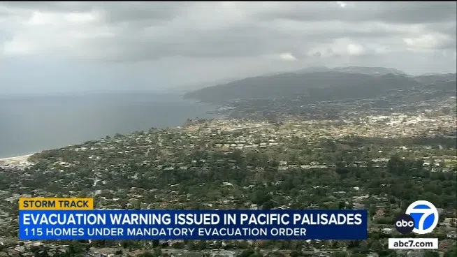
Evacuation warnings are in effect for parts of Southern California as a severe storm threatens communities vulnerable to mudslides. An evacuation warning is in effect through 6 a.m. local time Wednesday for areas impacted by the Palisades, Hurst and Sunset fires. One to four inches of rain could fall, but the worst of the weather should be north and east of Southern California by Tuesday evening.
The burn scars are seeing heavy rain. Rain is expected to fall at a rate of an inch to an inch-and-a-half per hour. Meanwhile, a severe thunderstorm warning is in place for the same burn scar areas, along with Santa Monica and the western San Fernando Valley. Wind gusts of up to 60-miles-per-hour are expected.
Numerous Bay Area communities are hoping to dry out later today after a Monday full of rain. Heavy rains fell around the region Monday, triggering localized flooding in numerous areas. A Flood Advisory was issued for most Bay Area counties as drivers tried to navigate numerous flooded roads. The wet weather also caused long delays at San Francisco International Airport.
Heavy rain continues to threaten Napa County’s Pickett Fire burn scar this morning even after a flash flood warning expired. The National Weather Service warns that rock, mud, vegetation, and other debris could move through areas east of Calistoga. This includes Simmons Canyon, Silverado Trail, Dutch Henry Canyon Road, Swartz Creek Bridge, the Pond Outlet, and Duvall Lake Outlet.

